Energy Update



When the Mountain Moves
Nepal’s Rasuwa Disaster: A Warning from a Warming Himalaya
-
 Amaan Aftab Farooqui
- 6 September, 2026
Abstract
The catastrophic flash flood occurring in the Nepal-Tibet border area during August 2026 is more than just a regular flash flood. Early investigations by the United States Geological Survey found that an unusually fast-moving mass of glacier ice along the upper slopes of Langtang National Park triggered an avalanche of ice, rocks and other material that entered the valley and the river causing catastrophic flooding downstream. This commentary highlights how the event reveals the growing divide between the increasing complexity of risks in the Himalayas and the traditional concepts behind floods monitoring, infrastructure development and public communications about these risks. Climate change cannot be yet considered as the sole reason for the above mentioned incident; however, fast warming, receding glaciers and other changes in the cryosphere create a new environment for these hazards. Based on analysis of the events in 2026, flood hazard research in High Mountain Asia, research on climate change perceptions in Nepal and hydropower adaptation to climate change, the author calls for moving away from river-based disaster risk management towards holistic mountain-to-river risk governance.

1. A Flood That Began in the Mountains
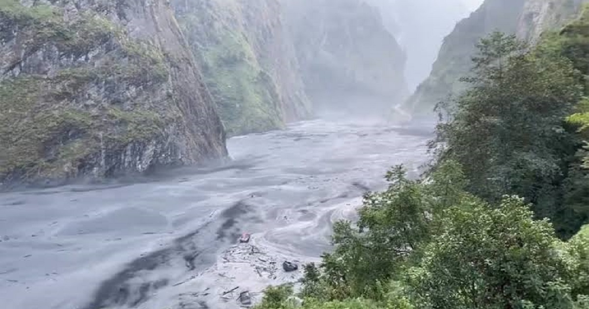
The first lesson that can be drawn from the Rasuwa disaster is the conceptually-related lesson. When defining this event as a “flash flood”, we focus on the downstream impact rather than the full hazard chain. According to the preliminary analysis performed by United States Geological Survey (USGS), this disaster was most probably induced by a rapid landslide involving a glacier in the region of Langtang National Park. Such an incident created a debris flow and flood, which moved through connected mountain valleys and river channels. USGS also observed that such a collapse created a seismic signal equivalent to a magnitude-5.2 earthquake. This lesson is very significant because the disaster chain started from the rapid mass movement in high mountains and only then turned into a river disaster.
For both scientific and policy reasons, this lesson is critical. Floods are traditionally defined in terms of precipitation and runoff and subsequent water level increase. However, the Rasuwa disaster demonstrates the importance of a cascading sequence of events that starts from mountain instability, gravity-induced acceleration, mobilization of debris and river interaction. Consequently, a warning system based on rainfall and downstream river level will detect only the consequences of this event but not the initial landslide.
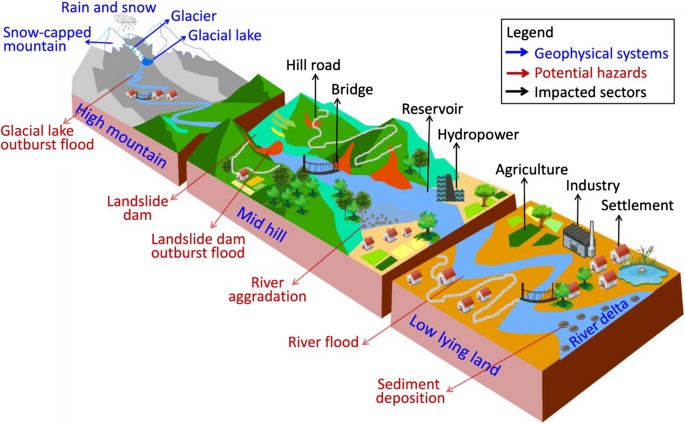 Figure 1. Conceptual mountain-to-river hazard cascade associated with the August 2026 Rasuwa disaster.
2. The Science of a Cascading Mountain Hazard
2.1 From Gravitational Potential Energy to Destructive Flow
High mountains have very high gravitational potential energy. If a substantial mass of ice, rock and sediments become unstable, this energy would be quickly transformed into kinetic energy under the influence of gravity. As it moves, it can become fragmented, pick up more materials and work with snow, meltwater and loose sediments. When it moves into the valley or river channel, new transformations will take place: water displacement, channel erosion, blocking and propagation of a debris-rich flow.
The main scientific idea here is that hazards do not necessarily develop sequentially. A slope movement triggers an avalanche; an avalanche interacts with the river; the river carries sediment and water; temporary impoundments create secondary hazards; and failure of structures downstream takes place sequentially. Therefore, the most important concept for analysis is not isolated hazards such as “flooding” or “landslide,” but a hazard cascade through the mountain-valley-river system.
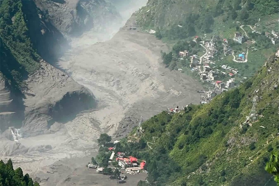
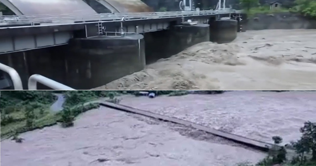
Figure 2. Rasuwa flood damages hydropower plants.
2.2 Why Narrow Himalayan Valleys Amplify Consequences
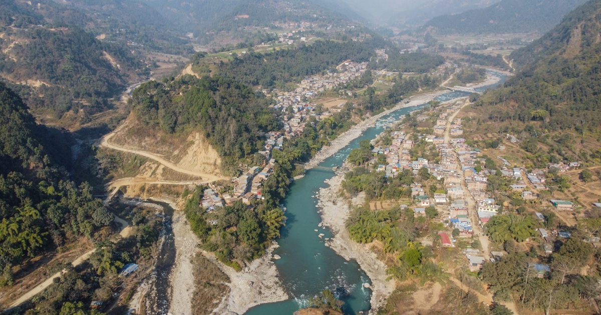
The topographic features of the Himalayan terrain in terms of the steep relief and narrow valleys help to channel the flow of energy and debris. Since settlements, roads, bridges, and hydroelectric plants are typically sited in these channels due to the fact that the valleys represent the only available route of movement and construction, there occurs a geographical coincidence of the route of natural energy flow and the route of human infrastructure.
3. Climate Change: The Trigger-Risk Distinction
The most important scientific caveat is the one against making claims that climate change is known to have caused the collapse of the slope at the end of August 2026. Event attribution research will need to be conducted in relation to this case, with specific focus on the slope, glacier shape and configuration, temperature history, hydrology, geology and triggering factors.
Nevertheless, lack of proven one-to-one relationship should not suggest that climate change plays no role in the process. Instead, it should be recognized that climate change is affecting the background conditions in which these events take place. Warmer conditions affect glacier mass balance, the state of snow and its meltwater runoff as well as, in some areas, soil and rock slopes stability due to higher temperatures. It follows that the questions of interest will not only be about whether the warming was responsible for the disaster but also what the warming does to future risk landscape.
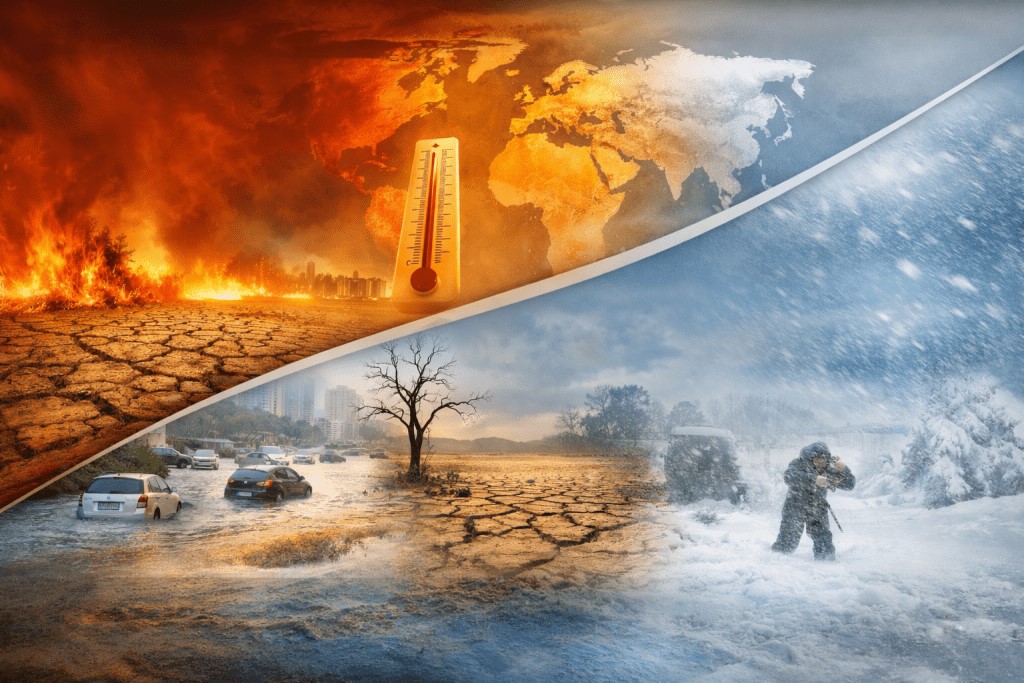
Figure 3. Global warming to climate change.
Based on the study of 1,015 floods in High Mountain Asia, ICIMOD drew attention to this larger trend back in 2025 which showed significant increase in flood frequency starting from 2000 and identified temperature rise as one of the major contributors to the increasing complexity of floods.
4. Warming Himalaya: Changing Hazards More Than Just Melt
Climate change in the Himalayas, however, tends to be talked about in one sentence: "the glaciers are melting." This simplification ignores other physical processes taking place, including the effects of glacier melting on the topography and runoff, changes in snow and ice cover leading to the emergence of new rock surfaces, alteration in the meltwater flow regime, changes in glacial lakes, and, in some cases, weakening of frozen ground that is part of slope stability system in high altitudes. These processes do not imply any particular slope will fail, but the boundaries of the system will be altered.
In such conditions, for Nepal, this implies that climate risk increasingly becomes a systems issue. The floods, landslides, glacial lakes, and infrastructure failure will not necessarily be managed separately from each other.
5. The Human Impact Beyond the Flood channel
The initial impacts of the disaster in Rasuwa are assessed in terms of the death toll and the number of people that are missing. But the local impact does not stop here. The damage caused to transport links and bridges can lead to the isolation of the community from food, medical care, and other forms of help. Lack of electricity and telecommunication can add to the problem of evacuation.
Therefore, mountain communities need to address many issues beyond debris removal: restoring transport links, ensuring electricity and telecommunication services, and securing livelihoods. The poorest households could find it most difficult to recover, as they usually have fewer financial resources available to cushion their losses.
6. From Climate Awareness to Risk Literacy
Climate change impacts are being experienced in Nepal in terms of changes in temperature, irregular rainfall patterns, droughts, floods, landslides, and changes in water conditions. However, general awareness does not necessarily imply preparedness.
In recent research conducted in central Nepal, climate perception varies depending on geographic location, education, employment and experience. For instance, a 2025 study comparing public perception and climatic conditions observation in lowland, midland, and highland districts including Rasuwa has proven the existence of climate perception based on experience. Another 2025 survey study indicates varying degrees of awareness and severity of climate change.
It is obvious from this research that the policy solution to the problem of climate change should go beyond providing general knowledge about greenhouse gases and increased temperatures. It should include risk perception among people who live in hazard-prone valleys. This means that they have to be aware of what a debris flow is, why a flood may happen even if there is no rain locally, what an official warning entails, where evacuation routes are, and which local signs indicate immediate danger.
7. Blue-Sky Floods: Why River Monitoring Isn’t Enough
The Rasuwa case clearly points out one major problem with traditional flood warnings. Rainfall measurements, weather predictions, and river measurements are still important, but they were never intended to pick up every potential failure at the mountain site. A mountain failure at some upper part of the valley might happen at a time when the weather seems to be pretty normal lower down. By the time the river gauge detects an extreme flow, there may be very little time left to act.
So, Nepal needs to consider the larger question "How do we detect dangerous changes in a mountain-river system?"
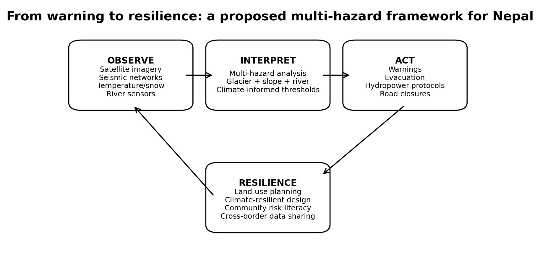 Figure 4. Proposed framework linking hazard observation, warning, response and resilience. Original schematic prepared for this article.
8. Implications for Nepal’s Hydropower Future
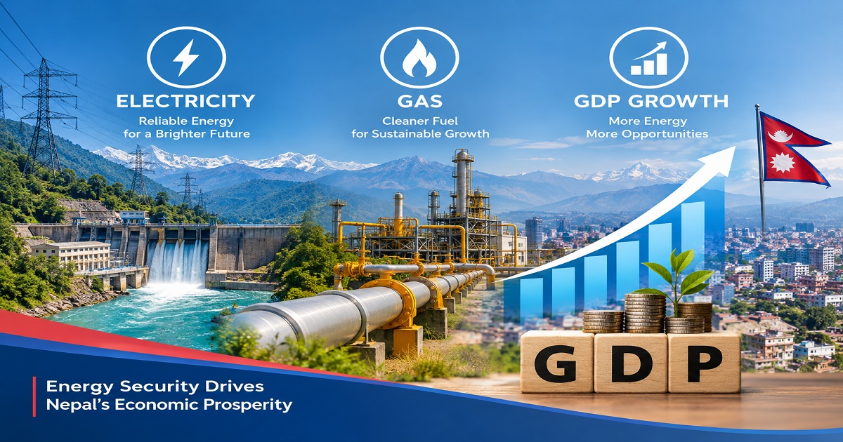
Apart from others, there is also an energy-related element to the Rasuwa tragedy for Nepal. Hydropower is at the center of Nepal’s aspirations for sustainable development. But hydropower facilities tend to cluster in valleys that are steep, and subject to landslide, sediment surge, extreme flooding and changes in cryospheric hazards.
It would be a mistake to conclude that this indicates a reduction in hydropower usage. Rather, what is required is a focus on making hydropower projects more resilient to climate change and other multiple hazards. Project siting, design floods, sediment considerations, emergency plans, access roads and transmission lines must be considered in terms of future rather than historical hazards. This is something that ICIMOD and Nepal’s water and energy institutions have already identified as requiring climate resilient hydropower guidelines and integrated geo-hazard assessments.
What needs to be done is not merely ensure that energy is clean, rather it is resilient. Megawatts installed are only one of the indicators. Can energy systems continue to operate, and if required, recover quickly under changing environmental conditions?
9. What Nepal Should Do Next
9.1 Shift from Single-Hazard to Cascade-Based Risk Assessment
Risk analysis must address the sequence, for example, slope collapse → river obstruction → breakout → downstream debris flow. Infrastructure networks must be evaluated at catchment and valley level, not just on-site.
9.2 Build Integrated Mountain-to-River Monitoring
Next generation system must include a combination of data from satellite, repeat topography, seismicity, meteorology, glacier, snow, and high-frequency river measurements. Each individual measurement method alone will not provide complete protection, and resilience is achieved by combining multiple independent sources of data.
9.3 Design Warning Systems for the Last Mile
Detection is only one part of the process. Warnings need to go out to the local governments, the owners of hydropower plants, the transport authorities, and local communities in a format that is comprehensible and actionable. The communication channels, evacuation plans, and exercises need to be incorporated into the scientific framework.
9.4 Climate-Proof Critical Infrastructure
Roads, bridges, hydropower stations, and transmission systems should be stressed using climate information and multi-hazard analysis. Nepal’s future infrastructure should be designed not only for the past experience of events but for the possible changes in extreme events.
9.5 Strengthen Cross-Border Science and Data Sharing
Himalayas constitute a trans-boundary physical system. Glaciers, rivers, and atmosphere cannot be restricted by political boundaries. Exchange of information on observations, satellite, rivers, and hazards by neighboring countries will cut down the response time for early detection to protection.
10. The Deeper Lesson: Making Resilience Part of Development
This is the time that calls not just for a temporary hiatus in development but a new way of thinking about development in the changing mountain landscape: are roads, settlements, energy installations and early warning systems being built to suit the conditions of the past or the conditions likely to prevail over the next few decades?
And it is at this junction that science and community knowledge have to converge. The future can no longer be planned through isolated scientific disciplines. A geologist knows of an unstable slope; a hydrologist models the water flows downstream; a climatologist analyzes temperature changes and an engineer redesigns the infrastructure, but the people will be safe only if the pieces come together into a functional risk management process.
Conclusion: The Next Flood May Begin in the Mountains
The Rasuwa tragedy needs to be treated as just that, and as a scientific case study secondarily. The human impact must always have to be at the center of any conversation about what happened.
Early indications are that this particular disaster was more than a run-of-the-mill flash flood event. There was a massive collapse in the high mountains which then triggered a downstream flood. While the warming of the region associated with climate change has not been identified as the sole cause of the disaster, it is changing the context in which the glaciers, snow, slopes, and rivers function.
The resulting policy question, therefore, is how to adapt for a much more complicated world. This means monitoring not only rivers but mountains; considering not individual hazards but cascading impacts; transforming awareness of climate change into risk literacy; and designing infrastructure for energy and transport that is both ambitious and resilient.
The country like Nepal may not alone act to prevent every landslide, glacier collapse, or flood. But it can reduce its vulnerability and the element of surprise. It can detect more of them, communicate faster, and design smarter. In a warming Himalaya, the next flood may not start with rain; it may start with a mountain.
References
1. U.S. Geological Survey (USGS). (2026). 2026 Nepal Debris Avalanche and Flash Flood. USGS Landslide Hazards Program. https://www.usgs.gov/programs/landslide-hazards/science/2026-nepal-debris-avalanche-and-flash-flood
2. ICIMOD. (2025). Temperature rise causes flood risk and complexity to soar in High Mountain Asia – Scientists. International Centre for Integrated Mountain Development. https://www.icimod.org/press-release/temperature-rise-causes-flood-risk-and-complexity-to-soar-in-high-mountain-asia-scientists/
3. Pathak, L., et al. (2025). Influence of knowledge sources on climate change awareness, risk perception and pro-environmental behavior in central Nepal. Discover Environment. https://link.springer.com/article/10.1007/s44274-025-00299-3
4. Phuyal, P., et al. (2025). On people’s perceptions of climate change and its impacts on environment and health in central Nepal. Peer-reviewed study indexed in PubMed. https://pubmed.ncbi.nlm.nih.gov/39946319/
5. Shrestha, R., et al. (2025). Awareness and Understanding of Climate Change for Climate Adaptation in Kathmandu Valley, Nepal. Sustainability, 17(7), 2819. https://www.mdpi.com/2071-1050/17/7/2819
6. ICIMOD. (2024). Developing climate resilient hydropower in the Hindu Kush Himalaya. https://blog.icimod.org/cryosphere-water-risks/climate-resilient-hydropower-development-in-the-hindu-kush-himalaya-a-race-against-climate-change/
7. World Bank. (2022). Key highlights: Country Climate and Development Report for Nepal. https://www.worldbank.org/en/brief/2022/08/28/key-highlights-country-climate-and-development-report-for-nepal
8. World Bank. (2022). In Nepal, 2 major climate disasters in a single year highlight the need to build resilience. https://www.worldbank.org/en/news/feature/2022/03/28/in-nepal-2-major-climate-disasters-in-a-single-year-highlight-the-need-to-build-resilience
9. Nature Reviews Earth & Environment. (2021). Himalayan glacier and hydrological change and associated risks. https://www.nature.com/articles/s43017-020-00124-w
10. npj Natural Hazards. (2026). Review of glacial lakes and related outburst-flood risks in the warming Himalaya–Karakoram region. https://www.nature.com/articles/s44304-026-00168-w
11. Asian Development Bank. (2024). The Roof of the World is Melting. https://www.adb.org/news/photo-essays/roof-world-melting
12. Reuters. (2026, August 26). Glacier collapse may have triggered deadly Nepal flash flood, experts say. Current-event reporting used for context; scientific mechanism prioritized from USGS.
13. Associated Press. (2026, August 28). Satellite images show bedrock and glacier collapsed on Nepal-China border, then rivers flooded. Current-event reporting used for context and expert commentary.
Farooqui, currently pursuing an MTech in Green Energy Technology at Pondicherry University.
Conversation
Amaan Aftab Farooqui
Amaan Aftab Farooqui, currently pursuing an MTech in Green Energy Technology at Pondicherry University.

More News

 pokharel.jpg)


- Nepal's First Energy Based News Portal
-
Energy Information Center Pvt. Ltd.
Hemant Marg-11, Babar Mahal, Kathmandu
- Info. Dept. Reg. No. : 254/073/74
- Telephone : +977-1-5321303
- Email : [email protected]